file:Kazakhstan political map 2000.jpg

Ii preview ke size: 800 × 515 pixels Duusra resolutions: 320 × 206 pixels | 640 × 412 pixels | 1,074 × 691 pixels.
Original file (1,074 × 691 pixel, file ke size: 384 KB, MIME type: image/jpeg)
Sanchhipt me
| Baare me |
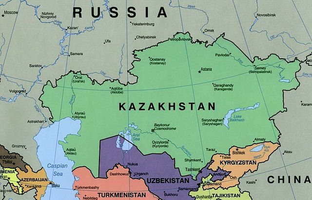
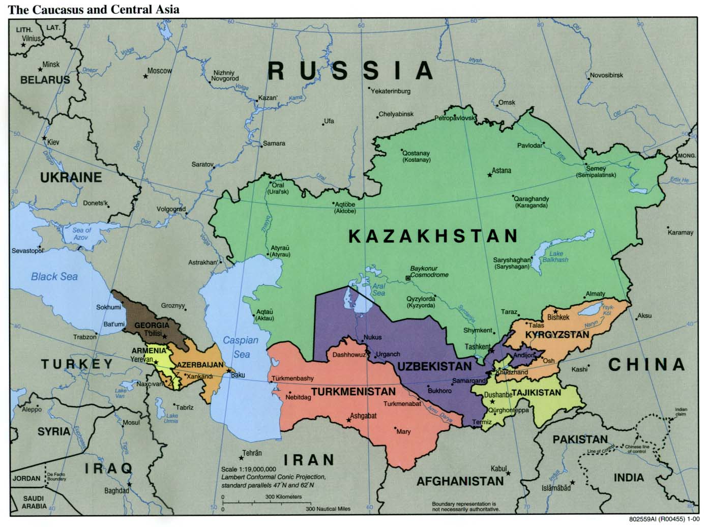
English: Kazakhstan Political Map 2000 |
| Taarik | |
| Source | University of Texas Libraries, Perry-Castañeda Library Map Collection: Kazakhstan maps. Extracted from "The Caucasus and Central Asia Political Map 2000" |
| Likhe waala | U.S. Central Intelligence Agency |
Licence ke baare me
| This image is a work of a Central Intelligence Agency employee, taken or made as part of that person's official duties. As a Work of the United States Government, this image or media is in the public domain in the United States.
|

|
File ke itihaas
File ke dekhe khatir, jaise uu time dekhe me lagat rahaa, date/time pe click karo.
| Din/Time | Chhota chapa | Lambai aur chaurai | Sadasya | Tiprrin | |
|---|---|---|---|---|---|
| abhi waala | 01:52, 9 Navambar 2004 | | 1,074 × 691 (384 KB) | Annalog~commonswiki | resized image |
| 01:45, 9 Navambar 2004 |  | 1,103 × 664 (480 KB) | Annalog~commonswiki | Kazakhstan Political Map 2000 |
File ke kaise kaam me lawa gais hae
Niche ke panna kaam me laae hai ii file ke:
Global file usage
Ii aur duusra wiki ii file ke use kare hai:
- ckb.wikipedia.org pe upyog
- de.wikibooks.org pe upyog
- en.wikipedia.org pe upyog
- fa.wikipedia.org pe upyog
- fi.wikipedia.org pe upyog
- gag.wikipedia.org pe upyog
- glk.wikipedia.org pe upyog
- gl.wikipedia.org pe upyog
- he.wikipedia.org pe upyog
- is.wikibooks.org pe upyog
- kk.wikipedia.org pe upyog
- pl.wikipedia.org pe upyog
- pl.wikinews.org pe upyog
- simple.wikipedia.org pe upyog
- sv.wikinews.org pe upyog
- sw.wikipedia.org pe upyog
- ta.wikinews.org pe upyog
- th.wikipedia.org pe upyog
- uz.wikipedia.org pe upyog