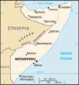
file:Somalia&land map.png
Somalia&land_map.png (330 × 355 pixel, file ke size: 9 KB, MIME type: image/png)
File ke itihaas
File ke dekhe khatir, jaise uu time dekhe me lagat rahaa, date/time pe click karo.
| Din/Time | Chhota chapa | Lambai aur chaurai | Sadasya | Tiprrin | |
|---|---|---|---|---|---|
| abhi waala | 18:14, 20 Juun 2020 |  | 330 × 355 (9 KB) | Chipmunkdavis | Reverted to version as of 09:58, 29 November 2005 (UTC) Map already indicates disputes |
| 10:06, 18 Juun 2020 |  | 330 × 355 (22 KB) | Meelpringthusss | added disputed area | |
| 09:58, 29 Navambar 2005 |  | 330 × 355 (9 KB) | *drew~commonswiki | Map of Somalia, including the boundary of the self-proclaimed Somaliland. Taken from en:Image:So-map-en.png {{PD-USGov-CIA}} |
File ke kaise kaam me lawa gais hae
Niche ke panna kaam me laae hai ii file ke:
Global file usage
Ii aur duusra wiki ii file ke use kare hai:
- am.wikipedia.org pe upyog
- ar.wikipedia.org pe upyog
- ast.wikipedia.org pe upyog
- bcl.wikipedia.org pe upyog
- be-tarask.wikipedia.org pe upyog
- bjn.wikipedia.org pe upyog
- ca.wikipedia.org pe upyog
- ckb.wikipedia.org pe upyog
- cs.wikipedia.org pe upyog
- da.wikipedia.org pe upyog
- de.wikipedia.org pe upyog
- de.wikinews.org pe upyog
- en.wikipedia.org pe upyog
- en.wikinews.org pe upyog
- Somali tensions rise as Ethiopia sends in troops
- Somali Islamists halt peace talks with government
- Islamist militia driven out of Mogadishu, vow to keep fighting
- Fifteen killed in Somalia bombing
- Violence in Somalia displaces over 27,000
- User:Bawolff/sandbox/Lead-only Main Page/leadList/Violence in Somalia displaces over 27,000
- At least twelve die in Mogadishu attacks
- eo.wikipedia.org pe upyog
- fa.wikipedia.org pe upyog
- fy.wikipedia.org pe upyog
- he.wikipedia.org pe upyog
- hi.wikipedia.org pe upyog
Ii file ke more global usage kedekho.

