file:Tasmania in Australia map.png
Aur achchha resolution nai hai.
Tasmania_in_Australia_map.png (200 × 186 pixel, file ke size: 11 KB, MIME type: image/png)
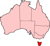
Localization of Tasmania in Australia

|
Ijaajat dewa jaae hae ii document ke copy, distribute aur kare ke,under the terms of the GNU Free Documentation License, Version 1.2 or any later version published by the Free Software Foundation; with no Invariant Sections, no Front-Cover Texts, and no Back-Cover Texts. A copy of the license is included in the section entitled GNU Free Documentation License. |
| ii file ke Creative Commons Attribution-Share Alike 3.0 Unported license ke niche licence karaa gais hai. | ||
| ||
| This licensing tag was added to this file as part of the GFDL licensing update. |

|
File:Tasmania in Australia.svg is a vector version of this file. It should be used in place of this PNG file when not inferior.
File:Tasmania in Australia map.png → File:Tasmania in Australia.svg
For more information, see Help:SVG. |
 |
History on English Wikipedia
- (delete all) (current) 23:20, 22 February 2004 Morwen (Talk | contribs | block) 200×186 11 KB
- (delete this) (revert) 08:45, 10 May 2003 Tim Starling (Talk | contribs | block) 200×181 4 KB Created by me based on Geoscience Australia data
File ke itihaas
File ke dekhe khatir, jaise uu time dekhe me lagat rahaa, date/time pe click karo.
| Din/Time | Chhota chapa | Lambai aur chaurai | Sadasya | Tiprrin | |
|---|---|---|---|---|---|
| abhi waala | 15:08, 12 Disambar 2004 | | 200 × 186 (11 KB) | Mschlindwein | Localization of Tasmania in Australia |
File ke kaise kaam me lawa gais hae
Niche ke panna kaam me laae hai ii file ke:
Global file usage
Ii aur duusra wiki ii file ke use kare hai:
- en.wikipedia.org pe upyog
- Coat of arms of Tasmania
- List of highways in Tasmania
- James Boag's Premium
- Tasmanian Conservation Trust
- Butlers Gorge Power Station
- Tasmania 40° South
- Colonial Secretary of Tasmania
- Office of the Tasmanian Economic Regulator
- Anthony Fenn Kemp
- Tasmanian Ports Corporation
- Agfest
- Mona Foma
- William Collins (colonist)
- Grecian (1824 ship)
- Cygnet Folk Festival
- Tasmanian Freight Equalisation Scheme
- Template:Tasmania-stub
- Bulbine crassa
- Currie Lighthouse
- Goose Island Lighthouse
- Electoral division of Westmorland
- Lune River, Tasmania
- Tasmanian University Football Club
- 2014 Tasmanian Legislative Council periodic election
- Tasmanian Electoral Commission
- Hope and Anchor Tavern
- Gormanston railway station, Tasmania
- 2015 Tasmanian Legislative Council periodic election
- Tasmanian Central Highlands
- Tasmanian Northern Midlands
- Tasmanian Northern Slopes
- Tasmanian West
- Tasmanian South East
- Tasmanian Southern Ranges
- King bioregion
- Ben Lomond bioregion
- Nieterana Power Station
- Deal Island Lighthouse
- Furneaux bioregion
- Tasmanian Government Personal Information Card
- 2018 Hobart floods
- Patterdale and Nile Farm
- Tasdance
- Lea Tree
- Solicitor-General of Tasmania
- hu.wikipedia.org pe upyog
- id.wikipedia.org pe upyog
- ja.wikipedia.org pe upyog
- nv.wikipedia.org pe upyog
Ii file ke more global usage kedekho.