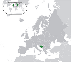
Šiprage
Šiprege (Шипраге) Bosnia and Herzegovina me hae.[1][2]
- Latitude: 44°27′56′′
- Longitude: 17°33′36′′
- Altitude: 507-520 m.


Climate
badloDemografi
badlo| Year | 1879. | 1885. | 1895. | 1910. | 1921. | 1931. | 1948. | 1953. | 1961. | 1971. | 1981. | 1991. | 2013. |
| Population | 64 (1.312♦) | 277 (1.575♦) | 88 (1.426♦) | 159 (760♦) | 999 | 5.098* | 1.774 | 7.764* | 828 | 822 | 1.183 | 952 | 788 |
- 1931, 1953: Municipal Šiprage.
♦ Area Šiprage
Reference
badlo- ↑ http://www.kartabih.com/
- ↑ Vojnogeografski institut, Ed. (1962): Šiprage (List karte 1:25.000, Izohipse na 10 m). Vojnogeografski institut, Beograd / Military Geographical Institute, Ed. (1962): Šiprage (map sheet 1: 25.000, Contour lines at 10 m). Military Geographical Institute, Belgrade.
- ↑ https://en.climate-data.org/location/905786/
- ↑ Štatistički zavod Zemaljske vlade BiH, ed. (1880). Štatistika miesta i pučanstva Bosne i Hercegovine – Službeno izdanje. Sarajevo: Zemaljska vlada Bosne i Hercegovine.
Weblink
badloWikimedia Commons mae Šiprage ke baare mae media chhapa hae.
- http://opstinakotorvaros.com/
- http://www.maplandia.com/bosnia-and-herzegovina/republika-srpska/siprage/ Maplandia
- http://www.satellitecitymaps.com/europe-map/bosnia-and-herzegovina-map/federation-of-bosnia-and-herzegovina-map/%C5%A1iprage-map/
- http://www.distancesfrom.com/distance-from-Siprage-to-Banja-Luka-Bosna-i-Hercegovina/DistanceHistory/5243320.aspx
- http://www.udaljenosti.com/bosna/-Template:Fix/category[dead link] Distances in B&H