file:2 Sri Kesgarh Takhat Anandpur Sahib Khalsa birthplace Himalayan foothills in view Punjab India.jpg
Ii preview ke size: 800 × 600 pixels Duusra resolutions: 320 × 240 pixels | 640 × 480 pixels | 1,024 × 768 pixels | 1,280 × 960 pixels | 2,560 × 1,920 pixels | 4,032 × 3,024 pixels.
Original file (4,032 × 3,024 pixel, file ke size: 2.86 MB, MIME type: image/jpeg)
Sanchhipt me
| Baare me |
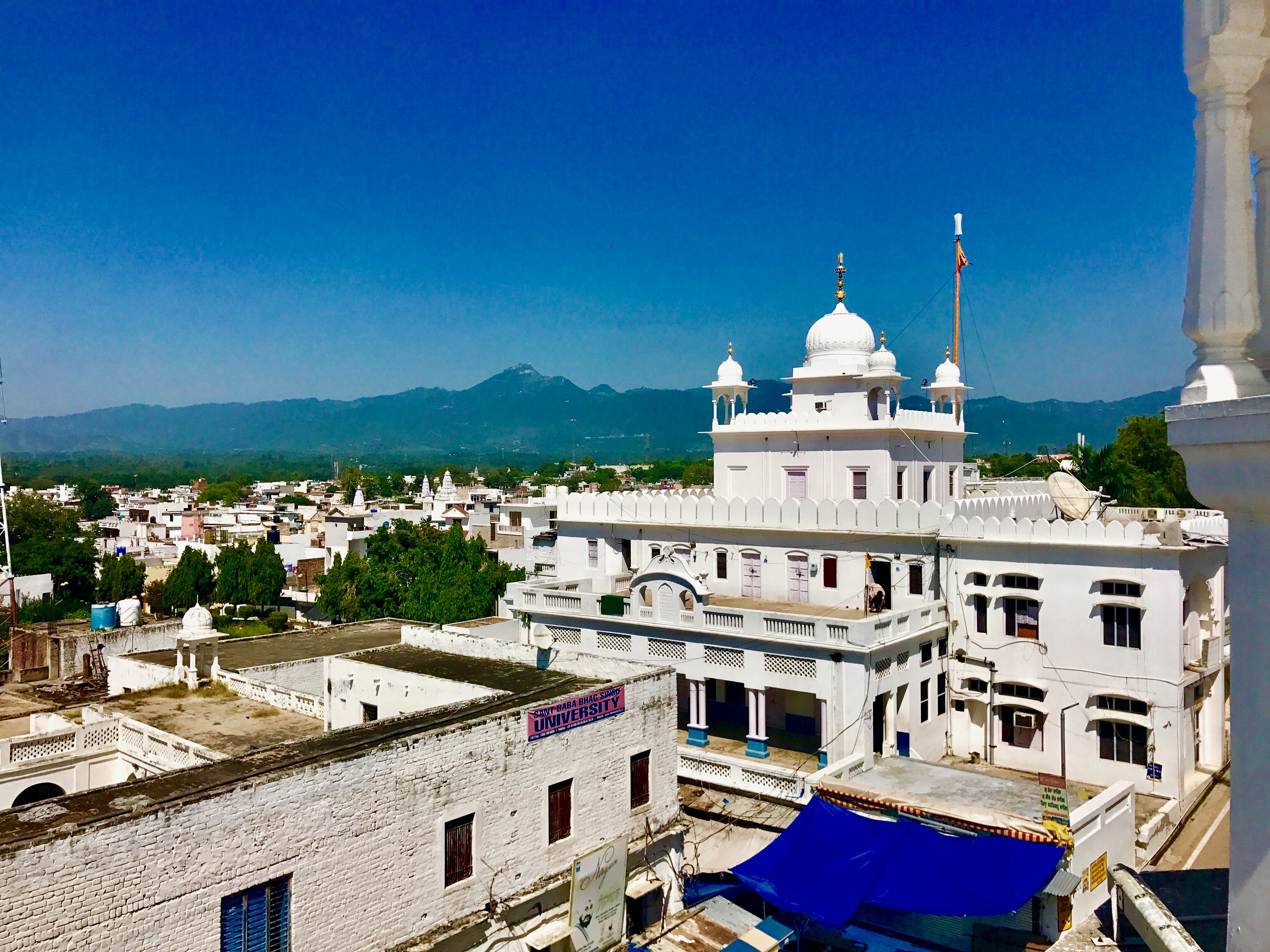
English: Takht Sri Keshgarh Sahib also known as Anandpur Sahib is the historic site in Sikhism where Khalsa was founded by Guru Gobind Singh.
It is located near Himalayan foothills near the river Satluj. The site is second only to Amritsar, the city of Golden Temple in the Sikh tradition. Anandpur Sahib was founded in the year 1665 by the ninth Sikh Guru, Tegh Bahadur. A small town is the site of major annual gathering of Sikhs for Hola Mohalla festival every year in spring when other parts of India are celebrating Holi. It is a festive gathering with a display of martial arts, fairs and gaiety. |
| Taarik | |
| Source | Aapan kaam |
| Likhe waala | Ms Sarah Welch |
| Camera location | | View this and other nearby images on: OpenStreetMap |
|---|
Licence ke baare me
I, the copyright holder of this work, hereby publish it under the following license:
This file is licensed under the Creative Commons Attribution-Share Alike 4.0 International license.
- You are free:
- share kare ke khaatir – to copy, distribute and transmit the work
- to remix – to adapt the work
- II condition ke niiche:
- attribution – Aap ke thiik credit de ke chaahi, licence pe jorr de ke chaahi, aur badlao ke dekhae ke chaahi. Aap iske koi reasonable manner me kare saktaa hai lekin aise nai ki lage ki licensor aap ke, nai to aap ke kaam ke endorse kre hai
- share alike – Agar aap milaata hai, badaltaa hai, nai to material pe jorrtaa hai, tab aap ke aapan yogdaan ke same or compatible license ke niche baate kare kae chaaahi.
File ke itihaas
File ke dekhe khatir, jaise uu time dekhe me lagat rahaa, date/time pe click karo.
| Din/Time | Chhota chapa | Lambai aur chaurai | Sadasya | Tiprrin | |
|---|---|---|---|---|---|
| abhi waala | 19:04, 24 Saptambar 2017 | | 4,032 × 3,024 (2.86 MB) | Ms Sarah Welch | User created page with UploadWizard |
File ke kaise kaam me lawa gais hae
Niche ke panna kaam me laae hai ii file ke:
Global file usage
Ii aur duusra wiki ii file ke use kare hai:
- bh.wikipedia.org pe upyog
- en.wikipedia.org pe upyog
- hi.wikipedia.org pe upyog
- kn.wikipedia.org pe upyog
- th.wikipedia.org pe upyog