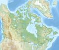
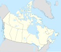
file:Canada relief map 2.svg

Size of this PNG preview of this SVG file: 709 × 600 pixels. Duusra resolutions: 284 × 240 pixels | 568 × 480 pixels | 908 × 768 pixels | 1,211 × 1,024 pixels | 2,422 × 2,048 pixels | 1,114 × 942 pixels.
Original file (SVG file, naam kare ke khatir 1,114 × 942 pixels, file size: 1.47 MB)
File ke itihaas
File ke dekhe khatir, jaise uu time dekhe me lagat rahaa, date/time pe click karo.
| Din/Time | Chhota chapa | Lambai aur chaurai | Sadasya | Tiprrin | |
|---|---|---|---|---|---|
| abhi waala | 17:44, 29 Disambar 2020 |  | 1,114 × 942 (1.47 MB) | MapGrid | added an international boundary line between Canada and St Pierre & Miquelon |
| 19:03, 25 Disambar 2020 |  | 1,114 × 942 (1.47 MB) | MapGrid | Christmas Day edition... more rivers | |
| 18:50, 15 Navambar 2020 |  | 1,114 × 942 (1.47 MB) | MapGrid | Uploaded own work with UploadWizard |
File ke kaise kaam me lawa gais hae
Niche ke panna kaam me laae hai ii file ke:
Global file usage
Ii aur duusra wiki ii file ke use kare hai:
- azb.wikipedia.org pe upyog
- ban.wikipedia.org pe upyog
- Taman Nasional Jasper
- Taman Nasional Banff
- Taman Nasional Glétsér (Kanada)
- Taman Nasional Cagar Palemahan Nahanni
- Taman Nasional miwah Cagar Palemahan Kluane
- Taman Nasional Wood Buffalo
- Taman Nasional Gros Morne
- Taman Nasional Aulavik
- Taman Nasional Auyuittuq
- Taman Nasional Grasslands
- Taman Nasional Cagar Palemahan Pagunungan Mealy
- Taman Nasional Samenanjung Bruce
- Taman Nasional Dataran Duur Cape Breton
- Taman Nasional Nusa Élk
- Taman Nasional Forillon
- Taman Nasional Kapuloan Celuk Georgian
- Taman Nasional Ivvavik
- Taman Nasional Cagar Palemahan Kapuloan Celuk
- Taman Nasional Cagar Palemahan Gwaii Haanas miwah Situs Tetamian Haida
- Taman Nasional Kootenay
- Taman Nasional Yoho
- Taman Nasional Sirmilik
- Taman Nasional Cagar Palemahan Lingkeh Pasifik
- Taman Nasional Danu Waterton
- Taman Nasional Cagar Palemahan Thaidene Nëné
- Taman Nasional Kejimkujik
- Taman Nasional La Mauricie
- Taman Nasional Cagar Palemahan Kapuloan Mingan
- Taman Nasional Gunung Revelstoke
- Taman Nasional Cagar Palemahan Náts'ihch'oh
- Taman Nasional Nusa Rajaputra Edward
- Taman Nasional Pukaskwa
- Taman Nasional Qausuittuq
- Taman Nasional Gunung Riding
- Taman Nasional Térra Nova
- Taman Nasional Thousand Islands
- Taman Nasional Pagunungan Torngat
- Taman Nasional Tuktut Nogait
- Lapangan BMO
- bg.wikipedia.org pe upyog
Ii file ke more global usage kedekho.


