file:LocationRomanEmpire.png
Ii preview ke size: 800 × 520 pixels Duusra resolutions: 320 × 208 pixels | 640 × 416 pixels | 1,084 × 705 pixels.
Original file (1,084 × 705 pixel, file ke size: 34 KB, MIME type: image/png)

|
File:Map of the Roman Empire at its height.svg is a vector version of this file. It should be used in place of this PNG file when not inferior.
File:LocationRomanEmpire.png → File:Map of the Roman Empire at its height.svg
For more information, see Help:SVG. |
 |
| Baare me |
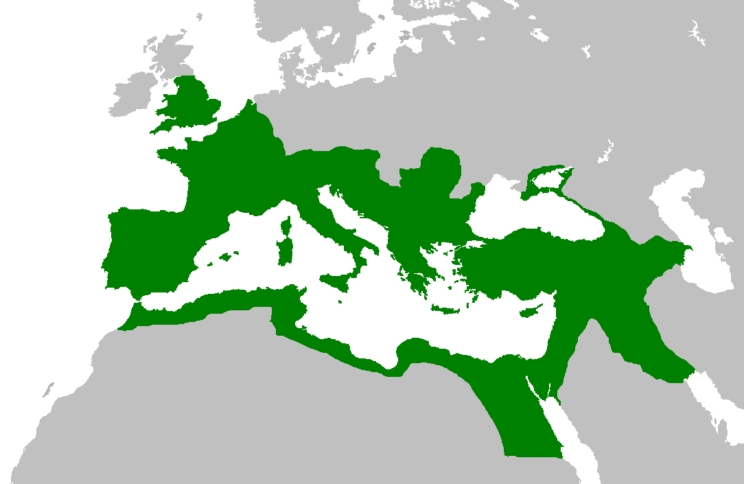
English: Map of the Roman Empire at its height, under Trajan.
Esperanto: Mapo de la Roma Imperio je ĝia plej vasta etendo, sub la imperiestro Trajano.
Español: El Imperio Romano a su máxima extensión, durante el reinado de Trajano.
Suomi: Rooman valtakunta Trajanuksen aikana.
Français : L'Empire romain à son apogée, sous Trajan.
Italiano: Mappa dell'Impero Romano al culmine della sua estensione, sotto Traiano.
日本語: 117年(トラヤヌス帝の時代)のローマ帝国の最大領土
Português: Localização do Império Romano em sua extensão máxima. |
||||||||
| Taarik | |||||||||
| Source | Previous version | ||||||||
| Likhe waala | User:Jrockley / User:Kasper Holl | ||||||||
| Adhikaar (Ii file ke fir se kaam me laawa jaae hai) |
|
||||||||
| Other versions |
|

File ke itihaas
File ke dekhe khatir, jaise uu time dekhe me lagat rahaa, date/time pe click karo.
| Din/Time | Chhota chapa | Lambai aur chaurai | Sadasya | Tiprrin | |
|---|---|---|---|---|---|
| abhi waala | 14:44, 2 Juun 2007 | | 1,084 × 705 (34 KB) | Medievalista | Ok, sorry, my mistake... here is the new map |
| 14:42, 2 Juun 2007 |  | 1,084 × 705 (34 KB) | Medievalista | Update of the previous map: less of teritory in Africa, withdraw in Britain up to the future Hadrianic wall and improve the trace of the Rhine-Danube frontier | |
| 03:45, 5 Farwari 2007 |  | 1,084 × 705 (35 KB) | Jrockley | lil bit more Africa, lil less Scandinavia | |
| 03:28, 5 Farwari 2007 |  | 1,259 × 756 (41 KB) | Jrockley | Much larger version, as faithful as possible | |
| 12:24, 9 August 2005 |  | 250 × 175 (8 KB) | Kasper Holl | Map of the location of the Roman Empire at its height, under Trajan. Made from the Blank Map World. |
File ke kaise kaam me lawa gais hae
Ii file ke koi panna kaam me nai laae hai.
Global file usage
Ii aur duusra wiki ii file ke use kare hai:
- en.wikipedia.org pe upyog
- he.wikipedia.org pe upyog
- hy.wikipedia.org pe upyog
- it.wikipedia.org pe upyog
- kk.wikipedia.org pe upyog